Mountain climbing and hiking on Rishiri Island and Rebun Island


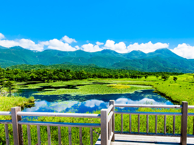
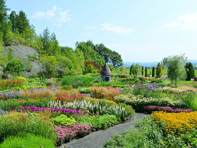
Club Tourism 's special feature on Rishiri Island and Rebun Island tours! With a tour guide, you'll be well supported! We introduce recommended tours around tourist spots on Rishiri Island and Rebun Island, such as Himenuma Pond, Otatomari-numa, Mt. Pon, and Rebun Forest Road, as well as information on seasonal flowers and recommended foods. Searching and applying for tours is easy.
Rebun Island Mountaineering and Hiking
Momoiwa to Shiretoko


初級
時間:150分 全長:5.7km 高低差:244m
桃岩展望台から島の南端・知床まで進むハイキングのハイライトコース。ため息が出るような天然の花畑の連続です。途中礼文島固有種のレブンキンバイソウ(見ごろ6月中旬~7月中旬)の群落「キンバイの谷」も通ります。つばめ山までの急な階段をのぼるとあとはなだらかな下りです。左右に咲く花々と海の向こうに浮かぶ利尻富士の美しい景色にそれまでのハイキングの疲れも癒されます。
Itinerary and travel time
Momoiwa Entrance 1km (35 minutes)→ Ranger House [W/C rest] 0.2km (5 minutes)→ Momoiwa Observatory [Retirement point] 1.5km (50 minutes)→ Kinbai Valley Tsubameyama 1km (50 minutes)→ Motoji Lighthouse 2km (40 minutes)→ Shiretoko
Search tours Each place of departure
* Departure Place button will only be displayed for departure Place of departure where tours are available.
Momoiwa Observatory


ミニハイキング
時間:60分 全長:1.2km(往復2.4km) 高低差:100m
礼文島で一番手軽に散策することができながら、多種多様の花々を観察できる散策コース。桃岩展望台からは桃岩・猫岩・利尻富士も堪能できるスポットです。気軽に花散策へ!
Itinerary and travel time
Momoiwa Entrance 1km (35min) → Ranger House [W/C rest area, retirement point] 0.2km (5min) → Momoiwa Observatory 1.5km
Return to the Momoiwa Entrance
*This is a round trip route, so you can turn back halfway.
Search tours Each place of departure
* Departure Place button will only be displayed for departure Place of departure where tours are available.
Rebun Forest Road


入門
時間:240分 全長:8km 高低差:100m
見晴らしの良い月の丘、星の丘を越えながらゴールの香深井までハイキング。数多くの高山植物が道の両端に咲いています。途中、丘一面に咲く輝く白いいのち「レブンウスユキソウ群生地」も通ります。長い道のりですが花一輪一輪、島風景との出会いが待っています。

キャプション:(イメージ)
レブンウスユキソウ群生地
開花時期:6月下旬~8月上旬
白色の葉に雪が積もったような姿をしていることから「ウスユキソウ」と名づけられ、礼文町の町花にも選ばれている「レブンウスユキソウ」(見ごろ6月下旬~8月上旬)。
まるで星空が降ってきたかのように丘一面に咲き誇るレブンウスユキソウ群生地までを往復します。
Itinerary and travel time
Forest road entrance 1.7km (50 mins)→ Rebun Usukisou Colony [W/C rest/retirement point] 1.5km (30 mins)→ Rebun Falls Entrance 4.8km (100min)→ Kafukai side entrance
*The round trip course to the Rebun-usuyukisou colony is from the forest road entrance to the Rebun-usuyukisou colony and back.
*The route may change slightly depending on the flowering situation.
Search tours Each place of departure
* Departure Place button will only be displayed for departure Place of departure where tours are available.
Rebun West Coast Edoya Mountain Trail - Cape Gorota - Cape Sukoton


入門
時間:180分 全長:7.5km 高低差:179m
礼文島のシーサイドフラワーロード・西海岸を歩きます。スタートは花の名所江戸屋山道。ゴロタ岬頂上までの道は左手に高山植物、右手に花々と海のコントラストが広がります。ゴロタ岬頂上から眺める景色は、花と海と島と空が織り成す心しびれる絶景で、礼文島のとっておきの場所です。
Search tours Each place of departure
* Departure Place button will only be displayed for departure Place of departure where tours are available.
Rishiri Island Mountaineering and Hiking
Climbing Mount Rishiri


登山
時間:11時間 全長:13km 高低差:1,510m
さいはてにそびえる利尻山の山頂を目指します。早朝から丸一日かけての長丁場の登山となりますが、利尻島内に連泊する行程でゆとりを持って挑みます。天気の良い日を選んで登山をする予備日付きのコースもあり、長年クラブツーリズムのツアーに同行している北海道在住の登山ガイド同行で、足場の悪い登山道などしっかりと皆様をサポートさせていただきます。さぁ!今年はぜひあの利尻山へ!!
Search tours Each place of departure
* Departure Place button will only be displayed for departure Place of departure where tours are available.
Equipment and Levels
Levels and features
| レベル | 特徴 | 歩行時間 |
|---|---|---|
| ミニハイキング |
スニーカーでもOK。標高差100m未満の平坦な道歩き。 |
2時間以内 |
| 入門 |
初めて「野山」を歩く方向き。標高差100m未満のほぼ平坦な道歩き。 |
3時間以内 |
| 初級 |
本格ハイクへのステップアップに!標高差100m以上のややアップダウンのある道歩き。 |
2~5時間程度 |
| 中級 |
軽い登山も含む本格的なハイキング。アップダウンのある道歩き。 |
5時間以上 |
Clothing and Equipment
■Walking Clothing
For most courses, you can wear casual clothes and sneakers as long as you are comfortable wearing clothes that are suitable for outdoor activities. Please prepare according to the content of the course you are participating in.
■ Hiking/Mountain climbing clothing


